
Autumn has kicked into gear in typical British fashion by being completely inconsistent, with the temperatures celebrating the dusky season by kicking themselves up a notch. This is no reason to complain, it is a reason to pursue one of my simpler seasonal goals: to explore some new run routes, ideally involving some hills.
Last week I checked out the Lyveden Way, which I think is going to be a nice cross-country route for the next few months, but it doesn’t really hit any hills.
Ivinghoe Beacon, on the other hand, is all hills.
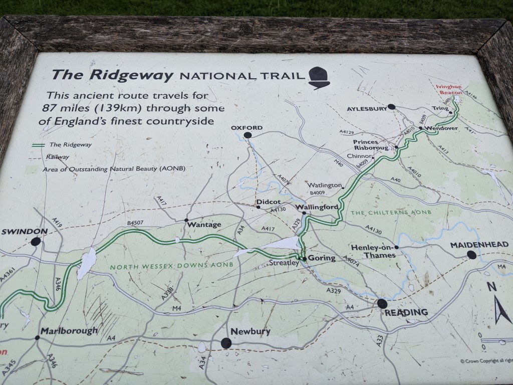
Ivinghoe is a village on one end of The Ridgeway – one of the oldest footpaths in Britain. It is also in the Chiltern Hills, a designated Area of Outstanding Beauty which stretches across Oxfordshire, Buckinghamshire, Hertfordshire, and Bedfordshire. You can join at any point of The Ridgeway, or the Chilterns, and be treated to walks of all lengths along sprawling, interconnected footpaths and bridleways, with some lovely views to be found.
But I wasn’t going there to walk.
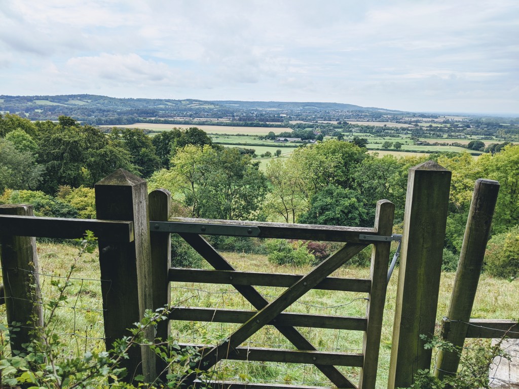
I wasn’t meant to run particularly hard either, but after parking my car in a free car park just below the Beacon itself, pace didn’t really come into the equation. The steep gradient of some of the climbs meant that I was working hard the whole way around, and I had to treat myself to a couple of moments of rest to soak up the views, and catch my breath, to make sure I wasn’t over doing it.
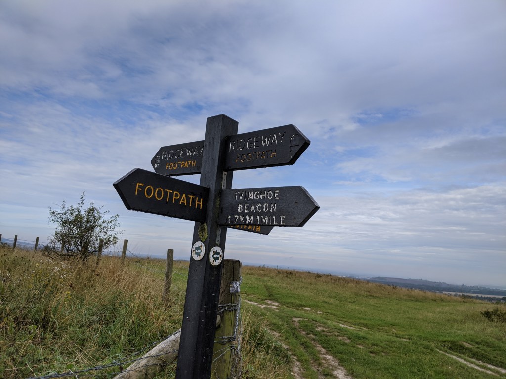
I had a circular route, which I had researched beforehand, loaded onto my phone, but I was more interested in finding my own way around so I headed up a wide grass footpath to join The Ridgeway and begin the first steep climb, from there winding my way around to a chalky escarpment, rolling up, and down, all the way to the Beacon. At the top I took a breather, took in the views, and then headed back down a different path.

This path zigzagged me down and around through a sheep field, which I picked through carefully, only disturbing a few of the jumpier sheep on the way. I was now facing the Beacon again, and faced a tremendously steep, grassy climb to a path which led away from the peak and which I could have followed (I think) in a wide circular of the surrounding grounds, but I was curious to survey the rolling hills on the other side of the car park, so I set down along another chalky path, taking a steep, fast course which led to the worst climb of the day, a deceivingly steep, and painfully long, route up to another car park, which I cut through to find myself back at the beginning of my run.
I took on some water and a gel at the car, and then headed off in the opposite direction along a rolling section of hills overlooking a quarry in the distance. At the end of this section the Ridgeway cut down into a peaceful segment of woodland, and once again I was faced with plenty of options to explore the wider area. I took a path which I hoped would loop me back around to the car park (I was already at 1,000ft of ascent for the day) in not-too-many miles. Thankfully my instincts were right, and the woodland path carried me through a right of way onto a bridleway around a golf course, and then finally onto a quiet slice of country road leading gently up, back to the car park. It was amazingly satisfying to create a loop of my own accord, exploring rather than following a pre-designated route.
Obviously I’m no pathfinder. I stuck to the right-of-ways and followed the signs, but there is no denying the satisfaction that I found in staying in the moment and making decisions on the fly, rather than stopping and checking my phone/map. It is also exciting to think about all the routes that I didn’t take, and the confidence that having one route already bagged will give me when I return.
Not that I intend to return too quickly. My quads won’t thank me for that.
